Sometimes we overthink it. We (*ahem*) create big curriculum maps full of dynamic problem based lessons created by the most intrepid teachers on the internets. As useful and helpful as these are, the most reliable-to-hit-the-content, easiest-to-plan problems come from stuff that already exists. Textbooks and online problem sets are the most robust source of quality problems, with a little massaging. After all, some brave soul has already ginned up the context. It’s on us to make the task work best for our students.
Here’s a how I took a problem from a worksheet and turned it into a Problem Based lesson.
I was looking for a starting point for constructions, specifically using a compass and straight edge and constructing a perpendicular bisector. I came across a scenario I quite liked from NCTM’s Illuminations. The scenario involved identifying pizza delivery regions. (The original task is behind a paywall, but I strongly recommend you shell out the bucks for a NCTM membership if you don’t have one already.)
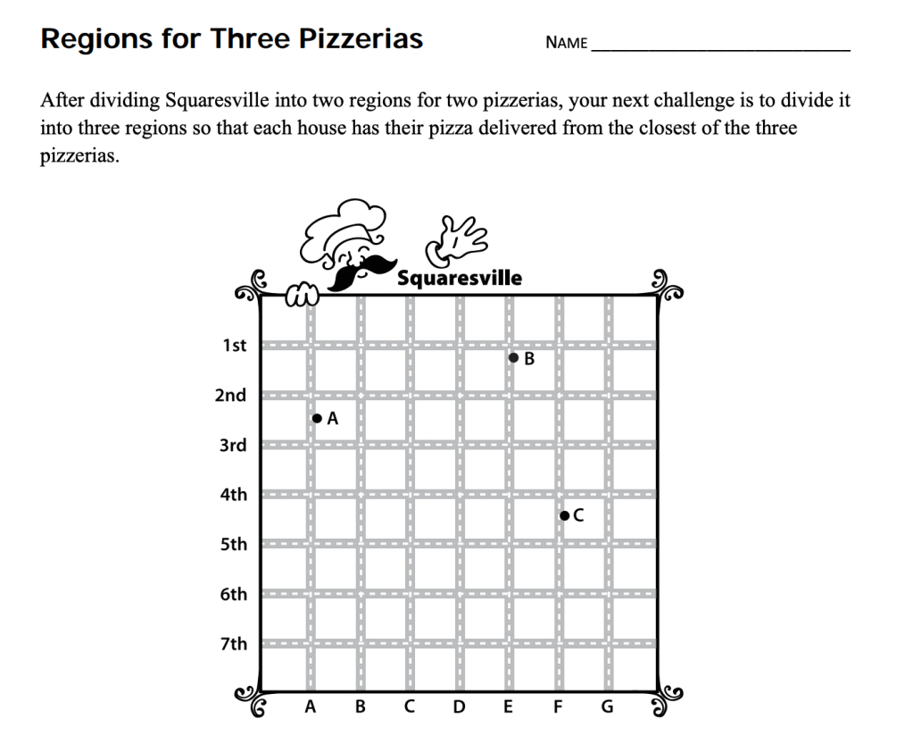
I liked the task because it was approachable, was highly dependent visuals, and allowed students to jump right in, regardless of prior learning. That is, the task is accessible for all students without much additional modification. It also could provide interesting discussions about how much area should each pizza place be responsible for.
However, I think we can do better. Aside from the infantilizing mustachioed pizza guy (?), it has a hyper fake street system. So how can we provide a slightly more real scenario? As a shot in the dark, I went local. I googled “fort collins dominoes.” That yielded two things. One, the request “did you mean ‘fort collins dominos‘?” And the following map:
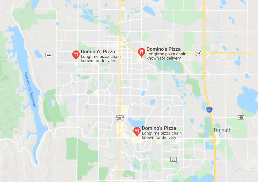
This is perfect! Three pizza places moderately spaced apart. Too, I like the fact that there might be some quibbling when it comes to HWY 287 and regions to the West of Horsetooth Reservoir. While a certain region may be closer as the crow flies, it might make sense to have it in the purview of a different store.
The other thing I wanted to do was pose this as a proper problem launch. So rather than having students dutifully proceed through a worksheet, I constructed a solicitation:
Problem Based Learning (PrBL) Entry Event
Greetings Geometry students,
Domino’s Pizza has three locations in Fort Collins, CO. I would like you to determine the delivery zones for each. When a customer enters their address in the delivery’s website, it should automatically connect them to the closest store.
Below is a map of Fort Collins with each of the three Domino’s Pizza locations. Use whatever tools, reasoning, and discussion you can to design the delivery zones for each. Please ensure that the delivery zones cover ALL of Fort Collins (including Timnath).
Here is a larger version of the map.
Your final document should include the following:
- Your proposed delivery map
- A written explanation of how you developed that map
Good luck!
Notice that nowhere in this solicitation does it prompt students to procure a compass and straightedge or a mirah. They are prompted to develop a written explanation on how they divined their map.
All that remained was how I would assess the task. A rubric will do nicely.
And voila! We have our Problem Based Lesson: Pizza Delivery Regions. I’ve presented about this before (Adaptation NCTM 2015) if you’d like to delve in to additional adaptation strategies and sample tasks.
